
Last year, Google Maps expanded the Live View AR feature to Android and iOS devices that support ARCore and ARKit. Google Maps this week announced a major update for Live View to make it even easier to orient yourself in the world when you’re walking around, leaving a public transit station, or meeting up with friends. Read about the new improvements below.
Landmarks:

You’ll be able to see nearby landmarks so you can quickly and easily orient yourself and understand your surroundings. Live View will show you how far away certain landmarks are from you and what direction you need to go to get there.
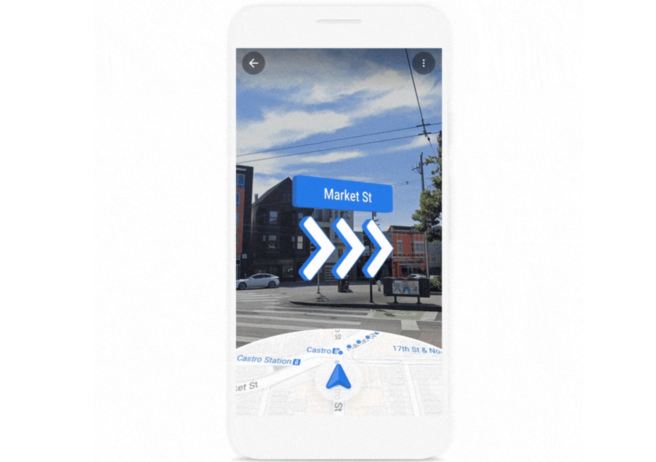
Live View during transit:

Now, if you’re using transit directions and have a walking portion of your journey, you can use Live View to find your way. This is particularly useful when you exit a transit station and don’t know which way to go.
Live View in location sharing:

When a friend has chosen to share their location with you, you can easily tap on their icon and then on Live View to see where and how far away they are–with overlaid arrows and directions that help you know where to go.
Availability details:
- Live View in the transit tab and Location Sharing on Android and iOS in the coming weeks, along with a more accurate pin.
- Landmarks start rolling out soon on Android and iOS in 25 cities around the world, with more to come. The available 25 cities are listed below.
- Amsterdam, Bangkok, Barcelona, Berlin, Budapest, Dubai, Florence, Istanbul, Kuala Lumpur, Kyoto, London, Los Angeles, Madrid, Milan, Munich, New York, Osaka, Paris, Prague, Rome, San Francisco, Sydney, Tokyo, Vienna
Source: Google